Friday, 22 March 2013
Harting Down circular approx 5.5 miles 13/3/13
Length: Approx 5.5 miles
Time: Approx 2 1/2 hours at a reasonable pace
Ascent: +-260m
Parking at Harting Down is free for National Trust members but there are plenty of other places to park for free.
1. There was still a bit of snow left in this woodland of small silver birch.
2. King Alfred's Cakes, daldinia concentrica.
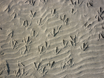
3. Pheasant tracks.
4. This is the only entrance to the deer enclosure. I can't find out any information about the enclosure but it is not maintained for the public although access is allowed so there are no marked paths or signposts. Looking at the map I reckon it covers an area of about 200 acres so if you go any distance make sure you have a map and compass. It can be quite disconcerting.
5. We only caught brief glimpses of the deer. Next time we visit we'll give ourselves more time and find somewhere to sit quietly. There is a definite feeling of wildness about the place and a fantastic assortment of yew trees.
6. The view over South Harting from Harting Down.
7. Approaching South Harting and looking back to Harting Down.
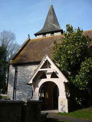
8. St Mary and St Gabriel Church, South Harting.
Stockbridge circular approx 8 miles 4/3/13
Length: Approx 8 miles
Time: Approx 3 1/2 hours at a reasonable pace
Ascent: +-170m
Parking is free in Stockbridge High Street
1. Crossing the River Test for the first time today. The Test is one of the best chalk rivers in England. Unfortunately it seems hard to see much of it due to private ownership.
2. Guinea Fowl (and quail in there somewhere).
3. The tiny yellow dot on the right is a treasure hunter. Could be a long job!
4. Danebury Hill Iron Age Fort. The fort and its surrounding chalkland is grazed by Manx Loughton sheep and Exmoor ponies. We saw a small flock of skylarks.
5. St Mary's Church, Longstock.
6. Picturesque cottages in Longstock. The village has a very good website but I can't find out the history of the unusually named road 'The Bunny'.
7. A fishing hut on the River Test together with eel traps spanning the river.
8. I am reliably informed that these trees with their fantastic orange tops are crack willow.
9. Either Ruby Elfcup Sarcoscypha coccinea or Scarlet Elfcup Sarcoscypha austriaca.
Wednesday, 6 March 2013
Midhurst circular approx 4.5 miles 1/3/13
Length: Approx 4 1/2 miles
Time: Approx 2 1/2
hours at a reasonable pace.
Ascent: +-89m
Easy free parking on side roads off the A272 as you approach Midhurst centre.
1. Central Midhurst.
2. An idyllic garden - snowdrops and a tributary of the Rother.
3. The view northwards to Cowdray Park.
4. My old favourite, Trametes versicolor (baby version this time).
6. Fantastic bark - sweet chestnut we think.
7. The remains of a Norman castle.
8. Cowdray.
9. Parish Church of St. Mary, Easebourne......
10. .....and its graveyard.
Tuesday, 5 March 2013
West Wittering circular approx 5 miles 18/2/13
Time: Approx 2 1/2
hours at a slowish pace.
Ascent: +-2m
Easy parking on the B2179.
1. Looking across Snow Hill Creek to East Head.
2. Wild Violet Viola papilionacea Pursh p.p.
3. Part of the new West Wittering tidal flood defences. Originally due to be finished in 2012 work was delayed by the horrendous wet weather. It is now due to be finished in Spring 2013.
4. Looking roughly north across the harbour and Thorney Island.
5. East Head is one of our favourite spots on the south coast. On a sunny day it's like a tropical island.
6. This and the previous photo are of the inside curve of the head. At high tide it fills up and only leaves a thin strip of beach.
7. Every day the tide washes the sand clean and the wildlife leaves its mark.
8. Sand sculpted by the movement of the tide.
9. At high tide this yacht would be able to come straight across where I'm standing.
9. The dunes are very vulnerable to erosion on the western side. These dunes have suffered a landslide during the winter storms.
10. This is West Wittering beach looking towards East Wittering. On a warm summer's day it would be packed.
Subscribe to:
Comments (Atom)


